
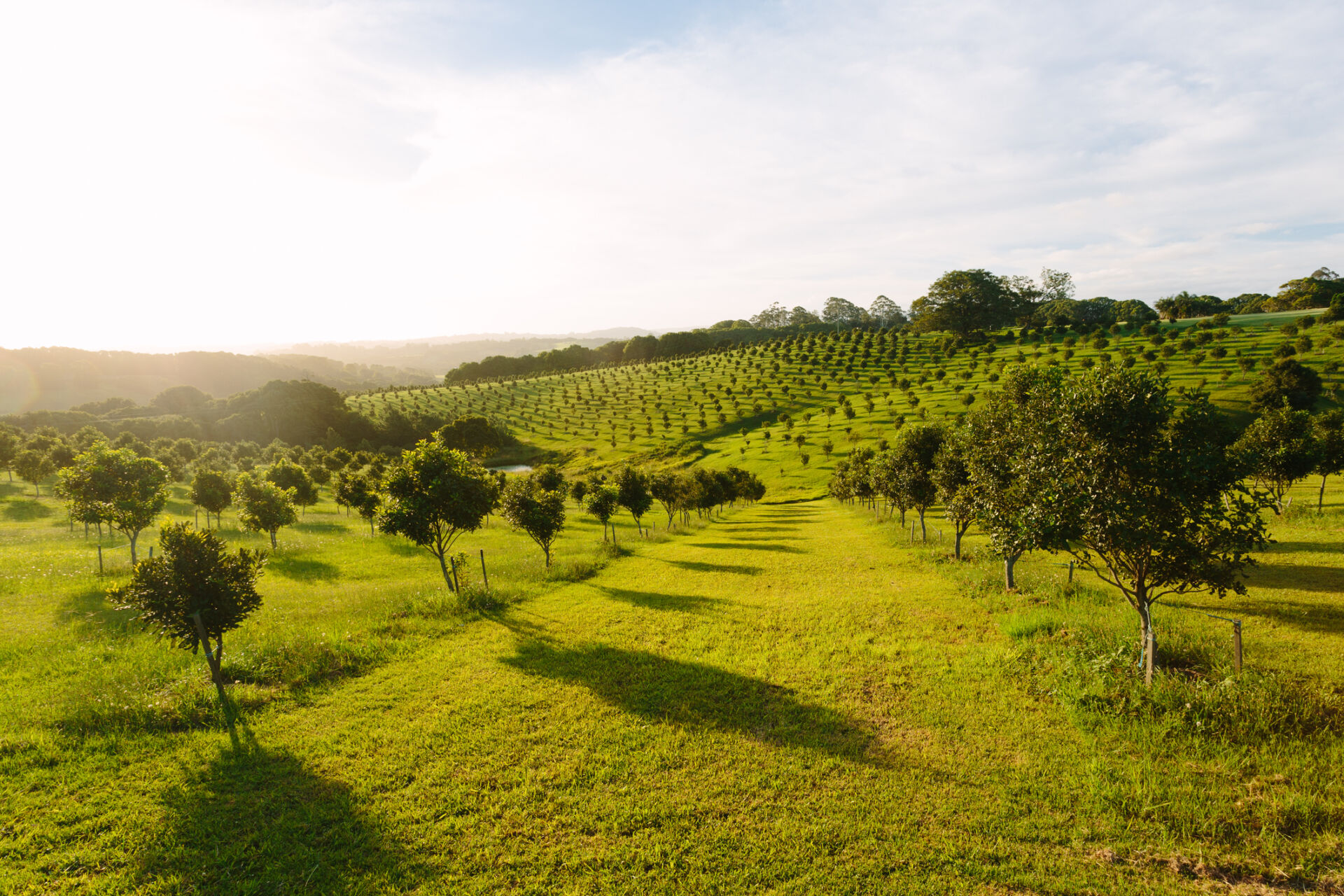
Examples include environmental plantings established for conservation purposes, agroforestry plantings, shelter/shade belts, forestry plantations, vineyards, orchards and other perennial food crops. Secondary (regrowth) forests are not included as plantations even if regrowth has been artificially managed or supplemented (see Native forests and woodlands).
This category corresponds to IUCN-GET Ecosystem Functional Group T7.3 (Plantations).
Metric:
Area of ecosystem asset
Please choose a Metric:
Canopy cover
Please choose a Metric:
Forage for livestock
Please choose a Metric:
Forage for livestock - monetary value
Units
Example methods / guidance / references
What are tiers?
Tier 1
Estimate using own judgement and observations
For example, estimate % of total land area covered by ecosystem type, multiplied by total land area.
Tier 2
Estimate using third-party professional estimates or public data
Tier 3
Model or measure based on site-specific surveys/sampling, remote or in-field sensing, laboratory analysis, etc.
Example data sources
Internal records
Third-party data sources
To the best of our knowledge there is not currently any interactive map of Australian ecosystem extent classified according to the IUCN-GET typology applicable at property-level scale. Maps of ecosystem extent classified according to the IUCN-GET typology for certain regions globally are available at the Global Ecosystems Atlas.
Maps showing extent of Australian forests, by type, are available at Forests Australia – Forest maps (select Interactive maps of Australia’s forests – Forests of Australia).
Site-specific measurements or model outputs
Data on Australian ecosystem extent classified according to the IUCN-GET typology are available at CSIRO Data Access Portal – Spatial extent of IUCN ecosystem functional groups at 250 m resolution for freshwater, terrestrial, marine and transitional realms for Australia: pre-1750, 2010-11, 2015-16 and 2020-21.
Data on extent of Australian forest and sparse woody vegetation are available at Data.gov.au – National Forest and Sparse Woody Vegetation Data (search for ‘National Forest and Sparse Woody Vegetation Data’ to find the latest version, e.g. National Forest and Sparse Woody Vegetation Data (Version 8.0 – 2023 Release).
Notes
Work in progress - Feedback welcome
Last updated: 8th May 2025
Type
SEEA ECT Class
Units
Example methods / guidance / references
What are tiers?
Tier 1
Estimate using own judgement and observations
Methods for measuring tree canopy cover and shrub layer cover can be found in AfN-METHOD-NV-01: Land Restoration Fund (LRF) Native Vegetation Monitoring Method. Methods for measuring woody thickening, % tree cover, % sub-canopy cover and % shrub cover can be found in AfN-METHOD-NV-08 Method to assess the productive and environmental condition of permanent perennial pastures throughout Australia.
Methods for measuring canopy cover, sub-canopy cover and shrub cover can be found in AfN-METHOD-NV-06 Accounting for Nature and Landcare Farming Native Vegetation Method.
Methods for measuring native tree canopy cover, non-native shrub/tree cover and native shrub cover can be found in AfN-METHOD-NV-07 Bush Heritage Australia – Vegetation Assessment Methodology.
Methods for measuring tree canopy cover and understorey lifeforms and dominant lifeform cover can be found in AfN-METHOD-NV-11 Tasmanian Vegetation Condition Method. See also Eyre et al. (2015) and Brack (1999) Forest measurement and modelling – Crown closure.
Tier 2
Estimate using third-party professional estimates or public data
Tier 3
Model or measure based on site-specific surveys/sampling, remote or in-field sensing, laboratory analysis, etc.
Example data sources
Internal records
Third-party data sources
Maps of Australian native forest by crown cover class are available at Forests Australia – Forest maps.
Site-specific measurements or model outputs
Data on canopy cover for Tasmania are available at CSIRO Data Access Portal – Annual woody vegetation and canopy cover grids for Tasmania.
Notes
The concept of canopy cover can apply to different levels of canopy, and can be measured separately for different types of vegetation. Canopy cover is also known as crown cover (for forests and woodlands) or foliage cover of tallest stratum (a more generic term that can be applied to a wider variety of ecosystem types).
Last updated: 24th October 2025
Type
SEEA ECT Class
Units
Example methods / guidance / references
What are tiers?
Tier 1
Estimate using own judgement and observations
Methods for measuring tree canopy height can be found in AfN-METHOD-NV-01 Land Restoration Fund (LRF) Native Vegetation Monitoring Method.
Methods for measuring tree height and sub-canopy height can be found in AfN-METHOD-NV-06 Accounting for Nature and Landcare Farming Native Vegetation Method and AfN-METHOD-NV-08 Method to assess the productive and environmental condition of permanent perennial pastures throughout Australia.
Method to assess the productive and environmental condition of permanent perennial pastures throughout Australia”. Methods for measuring native tree canopy height can be found in AfN-METHOD-NV-07 Bush Heritage Australia – Vegetation Assessment Methodology. See also Eyre et al. (2015).
Tier 2
Estimate using third-party professional estimates or public data
Tier 3
Model or measure based on site-specific surveys/sampling, remote or in-field sensing, laboratory analysis, etc.
Example data sources
Internal records
Third-party data sources
Maps of tree canopy height globally are available at Google Earth Engine – Global Canopy Height.
Maps showing tree canopy height for areas of Tasmania mapped with LiDAR are available at Land Information System Tasmania (LIST) – Tree Canopy Height.
Site-specific measurements or model outputs
Data on tree canopy height globally are available at Amazon Web Services (AWS) – High Resolution Canopy Height Maps by WRI and Meta.
Data on tree canopy height for areas of Tasmania mapped with LiDAR are available at Land Information System Tasmania (LIST) – Tree Canopy Height.
Notes
Work in progress - Feedback welcome
Last updated: 24th October 2025
Type
SEEA ECT Class
Units
Example methods / guidance / references
What are tiers?
Tier 1
Estimate using own judgement and observations
Methods for measuring coarse woody debris can be found in AfN-METHOD-NV-01 “Land Restoration Fund (LRF) Native Vegetation Monitoring Method”.
Methods for measuring fallen logs >100mm diameter can be found in AfN-METHOD-NV-07 “Bush Heritage Australia – Vegetation Assessment Methodology”.
Methods for measuring logs (forest communities only) can be found in AfN-METHOD-NV-11 “Tasmanian Vegetation Condition Method”. See also Eyre et al. (2015).
Tier 2
Estimate using third-party professional estimates or public data
Tier 3
Model or measure based on site-specific surveys/sampling, remote or in-field sensing, laboratory analysis, etc.
Example data sources
Internal records
Third-party data sources
Site-specific measurements or model outputs
Data on modelled estimates of Australian deadwood volume are available at Full Carbon Accounting Model (FullCAM).
Notes
Work in progress - Feedback welcome
Last updated: 6th January 2025
Units
SEEA ES sub-type
Intermediate or final
Example methods / guidance / references
What are tiers?
Tier 1
Estimate using own judgement and observations
Tier 2
Estimate using third-party professional estimates or public data
For example, estimate using satellite data or forage budget service providers.
Tier 3
Model or measure based on site-specific surveys/sampling, remote or in-field sensing, laboratory analysis, etc.
For example, model using satellite data plus formal on-site assessment including a stratified sampling scheme and data collection and analysis protocol.
Example data sources
Internal records
Third-party data sources
Site-specific measurements or model outputs
Notes
Grazed biomass provisioning is technically an intermediate service provided to livestock, with the livestock then providing the final service of livestock provisioning. However, following SEEA-EA 2021 (para. 6.56) it is recommended that grazed biomass provisioning is considered as the primary ecosystem contribution. Where there is a mix of ecosystem contributions and human contributions (e.g. through addition of fertiliser) to the grazed biomass provisioning service, ideally the ecosystem contribution should be estimated as a percentage of the total. Likewise, if measured via a proxy such as the stocking rate, corrections should be made for other inputs, such as supplementary feed (unless sourced from the same ecosystem, over the same time period).
Last updated: 6th January 2025
Units
Example methods / guidance / references
What are tiers?
Tier 1
Estimate monetary value of ecosystem contribution from residual value.
For example, deduct user costs (e.g. costs of production, extraction/harvesting and processing, plus financial costs such as depreciation and return on produced assets, minus subsidies on extraction, plus taxes on extraction) from revenues from extracted/harvested products, to derive a monetary value for the ecosystem contribution (NCAVES and MAIA, 2022).
Tier 2
Estimate monetary value of ecosystem contribution from replacement cost.
For example, estimate how much it would cost to feed livestock if the grazed biomass was not available (NCAVES and MAIA, 2022).
Tier 3
Estimate monetary value of ecosystem contribution from directly observed prices.
For example, if grazed land is privately owned and has a market price, then either an explicit price from a rental market or an implicit price derived from the market value of land, assuming a market rate of return, may be used to represent the right to use grazed biomass (NCAVES and MAIA, 2022).
Example data sources
Internal records
Third-party data sources
Site-specific measurements or model outputs
Notes
Work in progress - Feedback welcome
Last updated: 3rd December 2024
Type
SEEA ECT Class
Units
Example methods / guidance / references
What are tiers?
Tier 1
Estimate using own judgement and observations
Tier 2
Estimate using third-party professional estimates or public data
Tier 3
Model or measure based on site-specific surveys/sampling, remote or in-field sensing, laboratory analysis, etc.
Example data sources
Internal records
Third-party data sources
To the best of our knowledge, there is no definitive, up to date map of Australian native or plantation forests by age class (also known as growth stage). A map of Tasmanian forests by growth stage is available at p. 38 in State of the forests Tasmania 2022 data report.
Site-specific measurements or model outputs
Data on Australian plantation forests by type and age class are available at the latest version of Australia’s State of the Forests Report (e.g. see Australia’s State of the Forests Report 2018 – Indicator 2.1b: Age class and growing stock of plantations (2024).
Notes
Forest (or stand) age class may also be known as forest (or stand) growth stage. Forest (or stand) age in this context generally refers to the time since the last major disturbance, such as severe fire or timber harvesting. This applies particularly to even-aged forests or stands, and less so to uneven-aged forests or stands. Forests or stands can be classified into various different age classes or categories (e.g. younger regeneration, regrowth, mature and old-growth), depending on the growth rate and other characteristics of the specific type of forest.
Last updated: 6th January 2025
Units
SEEA ES sub-type
Intermediate or final
Example methods / guidance / references
What are tiers?
Tier 1
Estimate using own judgement and observations
For example, estimate number of productive units (e.g. beehives), multiplied by estimated product per unit.
Tier 2
Estimate using third-party professional estimates or public data
Tier 3
Model or measure based on site-specific surveys/sampling, remote or in-field sensing, laboratory analysis, etc.
Example data sources
Internal records
Third-party data sources
For example, third-party records of products harvested or delivered.
Data on harvested quantities of various Australian non-wood forest products are available at the latest version of Australia’s State of the Forests Report (e.g. see Australia’s State of the Forests Report 2018 – Criterion 6: Maintenance and enhancement of long-term multiple socioeconomic benefits to meet the needs of societies.)
Site-specific measurements or model outputs
For example, on-site records of products harvested or delivered, video surveillance data, etc.
Notes
Strictly, the ecosystem service of biomass provisioning is the ecosystem contribution to the gross biomass that is harvested, i.e. deducting the effect of human contributions such as planting, applications of fertiliser, weed management, etc. However, as it is difficult in practice to separate out or estimate these relative contributions, following SEEA-EA 2021 (s. 6.4, pp. 134-137), it is recommended that the physical flow of biomass provisioning services is assumed to be equal to the harvest in gross terms, i.e. before harvest losses, felling residues etc. are deducted.
Last updated: 6th January 2025
Units
Example methods / guidance / references
What are tiers?
Tier 1
Estimate monetary value of ecosystem contribution from residual value.
For example, deduct user costs (e.g. costs of production, extraction/harvesting and processing, plus financial costs such as depreciation and return on produced assets, minus subsidies on extraction, plus taxes on extraction) from revenues from extracted/harvested products, to derive a monetary value for the ecosystem contribution (NCAVES and MAIA, 2022).
Tier 2
Estimate monetary value of ecosystem contribution from prices in similar markets.
For example, if wild plants are foraged for own consumption, the value of this ecosystem contribution can be estimated from the price of similar foods sold in markets (less production costs, if applicable) (NCAVES and MAIA, 2022).
Tier 3
N/A
Example data sources
Internal records
Third-party data sources
N/A
Notes
Work in progress - Feedback welcome
Last updated: 3rd December 2024
Units
SEEA ES sub-type
Intermediate or final
Example methods / guidance / references
What are tiers?
Tier 1
Estimate using own judgement and observations
For example, estimate number of truckloads removed, multiplied by estimated volume or weight per load, adjusted to include estimated % waste/residues/losses.
Tier 2
Estimate using third-party professional estimates or public data
Tier 3
Model or measure based on site-specific surveys/sampling, remote or in-field sensing, laboratory analysis, etc.
Example data sources
Internal records
Third-party data sources
For example, third-party records of timber harvested or delivered.
Data on annual production of timber resources in Australia, by forest type, log type and state or territory, are available in the latest version of Australian Bureau of Agricultural and Resource Economics and Sciences (ABARES) – Australian forest and wood products statistics.
Site-specific measurements or model outputs
For example, on-site data from weighbridges, harvesting equipment, etc.
Notes
Strictly, the ecosystem service of biomass provisioning is the ecosystem contribution to the gross biomass that is harvested, i.e. deducting the effect of human contributions such as planting, applications of fertiliser, weed management, etc. However, as it is difficult in practice to separate out or estimate these relative contributions, following SEEA-EA 2021 (s. 6.4, pp. 134-137), it is recommended that the physical flow of biomass provisioning services is assumed to be equal to the harvest in gross terms, i.e. before harvest losses, felling residues etc. are deducted.
Last updated: 6th January 2025
Units
Example methods / guidance / references
What are tiers?
Tier 1
Estimate monetary value of ecosystem contribution from residual value.
For example, deduct user costs (e.g. costs of production, extraction/harvesting and processing, plus financial costs such as depreciation and return on produced assets, minus subsidies on extraction, plus taxes on extraction) from revenues from extracted/harvested products, to derive a monetary value for the ecosystem contribution (NCAVES and MAIA, 2022).
Tier 2
N/A
Tier 3
Estimate monetary value of ecosystem contribution from directly observed prices.
For example, if forest land is owned by one entity, and another entity pays the owner for the right to harvest a certain amount of timber or firewood, then this observed price (typically called the stumpage value) can be used as the basis for estimating the monetary value of the ecosystem contribution, after deducting the owner’s costs incurred in managing the land. Alternatively, if forest land is privately owned and has a market price, then either an explicit price from a rental market or an implicit price derived from the market value of land, assuming a market rate of return, may be used to represent the right to harvest, analogous to the stumpage value for a given area of land (NCAVES and MAIA, 2022).
Example data sources
Internal records
N/A
Site-specific measurements or model outputs
Notes
Work in progress - Feedback welcome
Last updated: 3rd December 2024
Type
SEEA ECT Class
Units
Example methods / guidance / references
What are tiers?
Tier 1
Estimate using own judgement and observations
Methods for measuring native tree canopy health can be found in AfN-METHOD-NV-07 “Bush Heritage Australia – Vegetation Assessment Methodology”.
Tier 2
Estimate using third-party professional estimates or public data
Tier 3
Model or measure based on site-specific surveys/sampling, remote or in-field sensing, laboratory analysis, etc.
Example data sources
Internal records
Third-party data sources
Site-specific measurements or model outputs
Notes
Proportion of healthy canopy cover present means the percentage of expected healthy canopy cover of individual trees, as appropriate to the species, ranging from a completely dead tree at 0% to a full canopy at 100%. It differs from canopy cover which generally applies at a larger scale and thus captures the gaps between tree canopies, as well as individual tree canopy density.
Last updated: 8th October 2024
Type
SEEA ECT Class
Units
Example methods / guidance / references
What are tiers?
Tier 1
Estimate using own judgement and observations
Methods for measuring non-native plant cover, or the percentage cover of the total vegetation cover that is comprised of exotic and non-indigenous species, using visual observation can be found in AfN-METHOD-NV-01 “Land Restoration Fund (LRF) Native Vegetation Monitoring Method” and AfN-METHOD-NV-06 “Accounting for Nature and Landcare Farming Native Vegetation Method“.
Methods for measuring lack of weeds, defined as weeds percentage cover of all native plant species, can be found in AfN-METHOD-NV-11 “Tasmanian Vegetation Condition Method”.
Tier 2
Estimate using third-party professional estimates or public data
Tier 3
Model or measure based on site-specific surveys/sampling, remote or in-field sensing, laboratory analysis, etc.
Example data sources
Internal records
Third-party data sources
Site-specific measurements or model outputs
Data on identified natural and modified areas of Australia are available at Find Environmental Data – Natural areas of Australia – 100 metre. Note that this source only provides a binary classification into areas presumed to be relatively natural, and those that have been highly modified – not the actual proportion of native species.
Notes
Work in progress - Feedback welcome
Last updated: 6th January 2025
Units
SEEA ES sub-type
Intermediate or final
Example methods / guidance / references
What are tiers?
Tier 1
Estimate using own judgement and observations
A variety of greenhouse gas accounting tools for Australian primary industries, some of which include methods to estimate sequestered and/or retained carbon, can be found at the Primary Industries Climate Challenges Centre (PICCC).
Tier 2
Estimate using third-party professional estimates or public data
Tier 3
Model or measure based on site-specific surveys/sampling, remote or in-field sensing, laboratory analysis, etc.
Example data sources
Internal records
Third-party data sources
Data on Australian forest and harvested wood product carbon stocks by state/territory and type of forest are available at the latest version of Australia’s State of the Forests Report (select Criterion 5: Maintenance of forest contribution to global carbon cycles).
Site-specific measurements or model outputs
Data on Australian carbon stocks are available at Full Carbon Accounting Model (FullCAM).
Notes
The ecosystem service of carbon retention is measured by the opening stock of retained carbon (see SEEA-EA s. 6.4.3, pp. 139-140) as a proxy for the flow of this service. The scope conventionally covers above- and below-ground living and dead biomass and soil carbon up to 2m depth. Carbon retained in harvested wood products should not be considered an ecosystem service (SEEA-EA, s. 6.4.3, pp. 139-140), although it could be included in an entity’s carbon account or impact statement. An increase in retained carbon from year to year should equal the flow of the ecosystem service of carbon sequestration.
Last updated: 6th January 2025
Units
Example methods / guidance / references
What are tiers?
Tier 1
Estimate monetary value of ecosystem contribution from avoided damages.
For example, multiply the total amount of carbon stored at the beginning of the accounting period by a suitable cost of carbon, and multiply this amount by a suitable rate of return to create an annuity representing the flow of retained carbon services. A suitable cost of carbon for Tier 1 might be a social cost of carbon derived from the literature (see discussion of the range of possible values in NCAVES and MAIA, 2022).
Tier 2
N/A
Tier 3
Estimate monetary value of ecosystem contribution from avoided damages.
For example, multiply the total amount of carbon stored at the beginning of the accounting period by a suitable cost of carbon, and multiply this amount by a suitable rate of return to create an annuity representing the flow of retained carbon services. A suitable cost of carbon for Tier 3 might be a social cost of carbon derived from a national model (see NCAVES and MAIA, 2022).
Example data sources
Internal records
N/A
Site-specific measurements or model outputs
Notes
Technically, the full price paid in ERF auctions per tonne of CO₂e sequestered is for the combined services of carbon sequestration and retention for 100 years. However, it can be assumed that the price component for annual retention is small, therefore the ERF price approximates the current value of carbon sequestration services.
Last updated: 3rd December 2024
Units
SEEA ES sub-type
Intermediate or final
Example methods / guidance / references
What are tiers?
Tier 1
Estimate using own judgement and observations
A map-based calculator for Australian landholders to estimate their emissions and annual sequestered carbon is available at the Platform for Land and Nature Repair (PLANR).
A variety of greenhouse gas accounting tools for Australian primary industries, some of which include methods to estimate sequestered and/or retained carbon, can be found at the Primary Industries Climate Challenges Centre (PICCC).
Tier 2
Estimate using third-party professional estimates or public data
Tier 3
Model or measure based on site-specific surveys/sampling, remote or in-field sensing, laboratory analysis, etc.
Example data sources
Internal records
Third-party data sources
Data on Australian forest and harvested wood product carbon stocks by state/territory and type of forest are available at the latest version of Australia’s State of the Forests Report (select Criterion 5: Maintenance of forest contribution to global carbon cycles).
Site-specific measurements or model outputs
Data on Australian carbon stocks are available at Full Carbon Accounting Model (FullCAM).
Notes
Additional tools are available to estimate potential changes in net emissions or sequestration from various project activities, such as LOOC-C.
Last updated: 6th January 2025
Units
Example methods / guidance / references
What are tiers?
Tier 1
Estimate monetary value of ecosystem contribution from directly observed prices.
For example, multiply the total amount of carbon sequestered over the accounting period by a suitable cost of carbon derived from observed prices in a relevant emissions trading scheme (NCAVES and MAIA, 2022). The relevant tier would depend on the granularity and accuracy of the underlying biophysical model and/or measurements used to estimate the physical flow of carbon sequestration services.
Tier 2
Estimate monetary value of ecosystem contribution from directly observed prices.
For example, multiply the total amount of carbon sequestered over the accounting period by a suitable cost of carbon derived from observed prices in a relevant emissions trading scheme (NCAVES and MAIA, 2022). The relevant tier would depend on the granularity and accuracy of the underlying biophysical model and/or measurements used to estimate the physical flow of carbon sequestration services.
Tier 3
Estimate monetary value of ecosystem contribution from directly observed prices.
For example, multiply the total amount of carbon sequestered over the accounting period by a suitable cost of carbon derived from observed prices in a relevant emissions trading scheme (NCAVES and MAIA, 2022). The relevant tier would depend on the granularity and accuracy of the underlying biophysical model and/or measurements used to estimate the physical flow of carbon sequestration services.
Example data sources
Internal records
Third-party data sources
Site-specific measurements or model outputs
Notes
Work in progress - Feedback welcome
Last updated: 3rd December 2024
Type
SEEA ECT Class
Units
Example methods / guidance / references
What are tiers?
Tier 1
Estimate using own judgement and observations
Tier 2
Estimate using third-party professional estimates or public data
Tier 3
Model or measure based on site-specific surveys/sampling, remote or in-field sensing, laboratory analysis, etc.
Example data sources
Internal records
Third-party data sources
Site-specific measurements or model outputs
Notes
Example variables relatively easily estimated include dominant tree height (a major influence on shelter) and % crown cover (a major influence on shade). More advanced variables include the above plus configuation (e.g. length, gaps, distance to sheltered area and orientation to prevailing wind). May involve basic modelling. Advanced variables include all of the above plus porosity in context of weather factors. May involve advanced modelling.
Last updated: 8th October 2024
Units
SEEA ES sub-type
Intermediate or final
Example methods / guidance / references
What are tiers?
Tier 1
Estimate using own judgement and observations
Tier 2
Estimate using third-party professional estimates or public data
For example, estimate using in-field, machine or animal sensing data and/or crop/pasture/livestock production models.
Tier 3
Model or measure based on site-specific surveys/sampling, remote or in-field sensing, laboratory analysis, etc.
For example, measure using in-field, machine and/or animal sensing data.
Example data sources
Internal records
Third-party data sources
Site-specific measurements or model outputs
Notes
Plantations can provide shade and/or shelter from wind, rain and/or snow as an intermediate service benefitting livestock, forage or crops for harvest as final services. The benefits should therefore appear in the financial accounts (in the form of increased productivity of livestock, pasture or crops) and/or elsewhere in the ecosystem accounts (under the ecosystem assets that benefit from the intermediate service). Nevertheless, it may be analytically useful to understand the contribution of shelter provision to these final services, as long as care is taken not to add the monetary value of intermediate and related final services together (see ecosystem services – monetary flows).
Shade and shelter services can be measured in various different ways, such as by measuring the contribution to additional yield (t/ha * ha affected) or contribution to additional liveweight (kg/standard animal unit * standard animal units affected).
Last updated: 1st October 2024
Units
Example methods / guidance / references
What are tiers?
Tier 1
Estimate monetary value of ecosystem contribution from replacement cost, or from avoided damages.
For example, estimate how much it would cost to provide shade or shelter if the ecosystem service was not available (replacement cost); or estimate the cost of avoided damages, such as lost production due to heat or cold stress, that would be incurred in the absence of the ecosystem service (NCAVES and MAIA, 2022).
Tier 2
Estimate monetary value of ecosystem contribution from an averting behaviour method.
For example, measure actual expenditure on the provision of artificial shade or shelter (NCAVES and MAIA, 2022).
Tier 3
Estimate monetary value of ecosystem contribution from a productivity change method.
For example, estimate the productivity change, such as increased production due to the effects of shade or shelter, resulting from the provision of the ecosystem service (NCAVES and MAIA, 2022).
Example data sources
Internal records
Third-party data sources
Site-specific measurements or model outputs
Notes
Work in progress - Feedback welcome
Last updated: 3rd December 2024
Type
SEEA ECT Class
Units
Example methods / guidance / references
What are tiers?
Tier 1
Estimate using own judgement and observations
Tier 2
Estimate using third-party professional estimates or public data
Methods for measuring site context, or the percentage of retained remnant vegetation, using GIS can be found in AfN-METHOD-NV-01 “Land Restoration Fund (LRF) Native Vegetation Monitoring Method”, AfN-METHOD-NV-06 “Accounting for Nature and Landcare Farming Native Vegetation Method”, AfN-METHOD-NV-07 “Bush Heritage Australia – Vegetation Assessment Methodology” and AfN-METHOD-NV-08 “Method to assess the productive and environmental condition of permanent perennial pastures throughout Australia“.
Methods for measuring neighbourhood context can be found in AfN-METHOD-NV-11 “Tasmanian Vegetation Condition Method”.
Tier 3
Model or measure based on site-specific surveys/sampling, remote or in-field sensing, laboratory analysis, etc.
Example data sources
Internal records
Third-party data sources
Maps of Australian vegetation types in a given area are available at the National Vegetation Information System (NVIS).
Maps of native and derived vegetation in a given area within the Australian Capital Territory are available at the ACT Government Geospatial Catalogue.
Site-specific measurements or model outputs
Data on Australian vegetation types in a given area are available at the National Vegetation Information System (NVIS).
Data on native and derived vegetation in a given area within the Australian Capital Territory are available at the ACT Government Geospatial Catalogue – ACTGOV Vegetation Map 2023.
Notes
Work in progress - Feedback welcome
Last updated: 6th January 2025
Type
SEEA ECT Class
Units
Example methods / guidance / references
What are tiers?
Tier 1
Estimate using own judgement and observations
Methods for assessing various soil condition metrics using on-site visual assessment can be found in North Central Catchment Management Authority’s Soil Health Guide .
A useful reference, particularly for rangelands soils, is Tongway and Hindley (2004).
Tier 2
Estimate using third-party professional estimates or public data
Tier 3
Model or measure based on site-specific surveys/sampling, remote or in-field sensing, laboratory analysis, etc.
Methods for measuring soil pH, soil organic carbon, salinity, extractable phosphorus and groundcover can be found in AfN-METHOD-S-02 “Level 3 Soil Assessment for Productive Land (Landcare)“.
Methods for measuring soil organic carbon, total nitrogen, soil pH, ground cover, salt-affected area/saline extent, soil electrical conductivity and bulk density can be found in AfN-METHOD-S-01 “Land Restoration Fund (LRF) Soil Health Monitoring Method”.
Example data sources
Internal records
Third-party data sources
Maps of various spatially modelled Australian soil variables are available at the Soil and Landscape Grid of Australia – Soil and Landscape Grid Viewer.
Maps of various spatially modelled and measured Australian soil variables are available at Visualising Australasia’s Soils (VAS).
Maps of various remote sensed Australian ground cover variables are available at Digital Earth Australia Map – DEA Fractional Cover.
Site-specific measurements or model outputs
Data on various spatially modelled Australian soil variables are available at the Soil and Landscape Grid of Australia – Get the Data.
Data on various measured Australian soil variables (obtained from various state and national data sources) are available at SoilDataFederator.
Data on various measured Australian soil variables are available at the Australian National Soil Information System (ANSIS) Data Portal.
Data on various remote sensed Australian ground cover variables are available at Digital Earth Australia – DEA Fractional Cover.
Notes
More advanced variables include the above plus pH, % SOC, salinity, NPK, Cation Exchange Capacity (CEC), soil water holding capacity. The depth and/or mass of soil covered by a measurement should be stated, ideally stating values for all layers within the soil profile to at least 1m depth. Advanced variables include all of the above plus biological functioning.
Last updated: 14th May 2025
Type
SEEA ECT Class
Units
Example methods / guidance / references
What are tiers?
Tier 1
Estimate using own judgement and observations
Tier 2
Estimate using third-party professional estimates or public data
Methods for measuring native plant species richness per life form (trees, shrubs, grasses and forbs/other) using visual observation can be found in AfN-METHOD-NV-01 “Land Restoration Fund (LRF) Native Vegetation Monitoring Method”.
Methods for measuring native species count for tree canopy and shrub layer species can be found in AfN-METHOD-NV-07 “Bush Heritage Australia – Vegetation Assessment Methodology”.
Tier 3
Model or measure based on site-specific surveys/sampling, remote or in-field sensing, laboratory analysis, etc.
Methods for measuring terrestrial mammal species richness using wildlife camera records can be found in AfN-METHOD-F-01 “Accounting for Nature Australian Terrestrial Mammal Method”.
Methods for measuring aquatic vertebrate species richness using eDNA measurement can be found in AfN-METHOD-F-05 “EnviroDNA Aquatic Vertebrate eDNA Method”.
Example data sources
Internal records
Third-party data sources
Maps showing the number of species in a given area are available at the Atlas of Living Australia (select layer: Species richness).
Site-specific measurements or model outputs
Data on the number of species in a given area are available at the Atlas of Living Australia (select layer: Species richness).
Notes
Species richness can be defined as “The number of species within a given sample, community, or area” (IPBES). It is one way of measuring species diversity, which is itself only one aspect of overall biodiversity. The concept of richness can also be applied at other levels, from genetic (e.g. the number of distinct genotypes within a species) to the number of represented genera, families, etc. It can be useful to supplement richness information with information on abundances or relative abundance distributions.
Depending on the purpose of measurement, and the measurement resources available, the concept of species richness may be applied to certain sets (e.g. plants, mammals, birds, invertebrates, endemic species, etc.). It is important to recognise that observations from one set may not apply to other sets in the same area.
It is usually not feasible to count all species, even within a limited set, within a given area. Therefore some form of sampling method is usually applied to come up with a sample set that can feasibly be measured. Many different sampling methods may be used, and the number of samples required will depend on the measurement objectives (e.g. desired accuracy and confidence), the sample measurement method (e.g. size of sample areas), and the actual variation in the measured quantity across the given area. There are also many different measurement methods and technologies at the sample measurement level (e.g. pit traps for insects, camera traps for animals, acoustic methods for birds). There is no single ‘right’ method that applies in all circumstances. Whatever method is used, it is important that it should be applied consistently for a given site over time, and appropriate to the measurement objectives and ecosystem type. Measurements using different methods may not necessarily be comparable.
Last updated: 6th January 2025
Type
SEEA ECT Class
Units
Example methods / guidance / references
What are tiers?
Tier 1
Estimate using own judgement and observations
Methods for measuring native tree density can be found in AfN-METHOD-NV-07 “Bush Heritage Australia – Vegetation Assessment Methodology”.
Methods for measuring stand density can be found at Forest Measurement and Modelling – Stand density.
Tier 2
Estimate using third-party professional estimates or public data
Tier 3
Model or measure based on site-specific surveys/sampling, remote or in-field sensing, laboratory analysis, etc.
Example data sources
Internal records
Third-party data sources
Site-specific measurements or model outputs
Notes
Work in progress - Feedback welcome
Last updated: 6th January 2025